Walk · East Riding of Yorkshire

Blacktoft to Faxfleet on the Humber floodbank

Blacktoft · DN14 7YW
N 880 YD
4.6MILES
2h 5mON FOOT
20mCLIMB
CircularSHAPE
Off-road 80% 20% shares tarmac with cars
Field & moor path 55%Lane & track 25%Road with traffic 20%

Our drawing of the route — the shape of the walk, not a navigation aid. Carry OS Explorer on the hill. Off-lead information here is what walkers reported or what signage allows — never our advice. Whether and when a dog is off the lead is the owner’s decision and legal responsibility; keep dogs under control near livestock and follow signs on the day.

Starts at
The bank end at the foot of Ings Lane, Blacktoft, below the church DN14 7YW
Parking
Free roadside parking on Ings Lane and along Blacktoft main street; there is no car park and no facilities in the village, and the RSPB car park down the road is for reserve visitors only
Directions to the start →

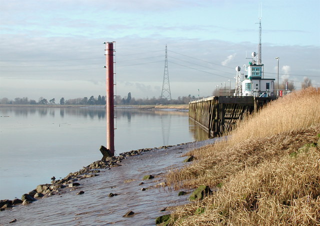
Out of Blacktoft down Ings Lane onto the top of the Humber floodbank, then east along the bank for the best two miles of estuary walking in the East Riding, with saltmarsh and reed below you and Alkborough Flats and the mouth of the Trent across the water. The bank runs along the landward edge of the RSPB's Blacktoft Sands reserve, and this matters: the reserve itself takes no dogs at all, but the right of way on the bank outside its fence is open, so you get the same reedbed and the same marsh harriers without going in. At Weighton Lock the return turns inland on the Faxfleet lane and the field tracks back across Blacktoft Ings. It is flat, exposed and utterly quiet, with no shade and no shop.

THE SMALL PRINTThe RSPB states for Blacktoft Sands: "Sorry, dogs are not permitted on the reserve, except assistance dogs, due to the sensitive wildlife and habitats here." That applies inside the reserve only. The public floodbank right of way outside it carries no dog order; the ings are grazed and the estuary mud below the bank is dangerous.

House rules, decoded

Off-lead allowed
Livestock — leads on
REGION · EAST RIDING OF YORKSHIRE
GRID · 53.7078, -0.7210
SOURCE · HTTPS://WWW.RSPB.ORG.UK/DAYS-OUT/RESERVES/BLACKTOFT-SANDS/FACILITIES
Also in Blacktoft

Know one we have missed?

Tell us the pub we have not walked into yet.

Local knowledge beats desk research every time. Name the place and we will check it properly — the venue's own policy, confirmed, then stamped and dated like every other listing.

Get the new stamps first.

One short email when we add places or a council changes its beach rules. No noise, easy out.

NO SPAM · UNSUBSCRIBE ANY TIME · WE NEVER SELL THE LIST

Wagfinder Members

Your patch, watched for you.

£4.99 A MONTH · OR £48 A YEAR
Restriction alerts for your saved beaches — know before the ban starts, not at the slipway sign.
New-place notifications in your area, the day we stamp them in.
Member perks at claimed venues across Britain.
Become a member

ENTER DOG OF THE MONTH · RESTRICTION ALERTS · CANCEL ANY TIME